Death Valley to Mt. Whitney-California
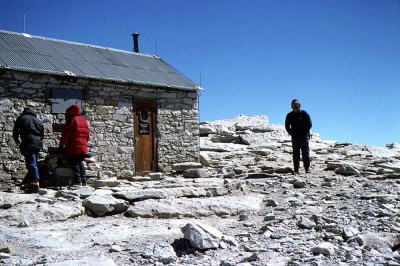
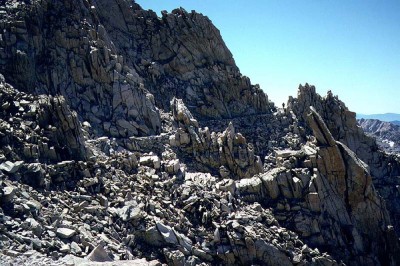
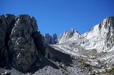
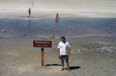
In 1997 my long time climbing partner (Tim) and I decided to head back down to the Sierras in California and give Mt. Whitney another go. We had been there the prior year and attempted the Mountaineers Route but due to heavy snow and ice conditions failed to make the summit. This time we agreed upon taking the standard non technical trail route. To throw in a little extra challenge we planned on driving to Bad Water in Death Valley National Park, back to Portal and then hiking to the top of Whitney, all within a 24 hour window, going from the lowest to the highest elevation points (minus 282 ft to 14,410 ft) in the Continental United States. After a short and inexpensive flight to Reno, Nevada we drove our rental car south along the eastern side of the Sierra mountains to the town of Lone Pine, California. After getting our hiking permit (John Muir Wilderness area) at the local Forest Ranger Station we found located the Portal Hotel where we secured a room and found the one and only bar for a number of beers to numb the flying and driving aches and pains. The next day we headed out early for the drive into Death Valley. The road snaked its way down and down and the temperature rose to 115 degrees once we arrived at the valley floor. Death Valley is an amazingly beautiful place and the drive to the lowest elevation in the continental United States took us past several interesting geological features; Devils Golf Course, Sand Dune and Artist Point. After a number of hours we finally arrived at Bad Water, elevation minus 282 ft. Bad Water is a mucky pond with a salt layer over mud. We stood around and took a couple of photos but found the place rather lack luster. Shrugging our shoulders and a nod, it was back into the car and back to Lone Pine. We headed back to our small motel room, slept for a few hours and drove to Whitney Portal at 8,360 ft and the trailhead. We started heading up the trail with headlamps before sunrise. Walking half asleep in the dark we moved fast and I really don’t remember much until the sun broke the horizon. It was brilliant and the darkness changed to a sky of magnificent blue. The trail to the summit of Whitney is 22 miles roundtrip with an elevation gain of 6,000 ft. There were a few small lakes (Lone Pine Lake, Mirror Lake and Consultation Lake) that were tempting rest spots both on the way up and down but we were pushing fast both directions. Once we reached Trail Camp at 12,039 ft we were slowed down by a large guided hiking/climbing party that were slowly plodding upwards on the 96 switchbacks that topped out at the Trail Crest at 13,777 ft. We just couldn’t get around them and for some strange reason all the clients had bells attached to their backpacks and whose ringing drove me crazy. We finally were able to run by and reach the crest and the John Muir Trail. The summit seemed far off as the trail headed up another large boulder field and eventually arriving at the stone hut on the large flat summit (5 hours and 40 minutes from the trailhead to summit). The wind was amazingly cold so we hugged the side of the shelter for about a half hour before the long downhill back to Whitney Portal. Journal:“The last two miles back to the parking lot was just brutal. I had used a different set of boots which I thought would be lighter and more comfortable than my usual leathers. The whole 11 miles downhill my toes slammed to the end of my boots and by the finish my toes were trashed. As soon as I reached the pavement I stopped, removed my boots, walked over to a dumpster and threw the boots in amongst the camp garbage. My feet and those boots departed enemies.”

Photos by Tim Hagan


Follow Kim Hood Photography on: